Equator
From the Condamine Expedition to indigenous knowledge
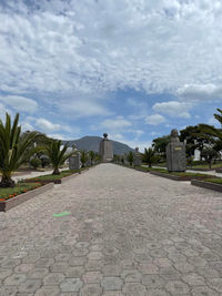
Since Ecuador translates to "equator", it's no surprise that we went to the equatorial line while visiting. However, it might come as a surprise to learn we went to two different equator landmarks! The equator line discovered by the Condamine Expedition is in a different location than indigenous peoples identified it.

Condamine Expedition
At the end of the seventeenth century, Isaac Newton proposed the Universal Theory of Gravity - that the earth was flat in the polar zones. He based this theory on measurements made by Abate Picard during the fifteenth century and the Centripetal Force Theory by Huygens. Picard used an iron ruler with a vessel and lens to see distance; the measuring tool was called "La Toesa de Chatelet". The tool, combined with trigonometry, helped Picard measure distance points between mountains, which are what he used as geodetic reference points. These measurements were taken in meters, which made it the first scientific use of the measurement.
In 1672, the astronomer Richer arrived at Cayenne. Here, he carried out observations in equatorial latitudes that confirmed both Newton and Huygens's theories.
Indigenous Knowledge
Indigenous peoples and the Incas used measurements acquired from the sun, stars, and constellations to calculate where the true equator lies. The Incas's cult of the sun tracked the sun's movement in reference to the surrounding mountains. They used angles created by the sun's shadow to identify direction and time. Through this, they were also able to create a world map more realistic than the one we're used to. This new map plots each country from east to west rather than north to south. This is because of the way the earth rotates, and where the sun lies at each rotation. The new map provides a better picture of the earth as it exists today than most modern maps/globes.


